Sign in for station measurements and the Barotse floodplain model.
ZAMSECUR
About the project
The Zambezi River, the fourth largest river in Africa, is shared by eight countries: Zambia (42%), Angola (18%), Namibia (1%), Botswana (1.5%), Zimbabwe (16%), Tanzania (2%), Malawi (7.5%) and Mozambique (12%). The Zambezi has a catchment area of 1.37 million km2, a length of 2 660 km and an average discharge of 4 100 m3/s at the outlet. In the main stream, there are two major hydropower dams: Kariba in Zambia/Zimbabwe and further downstream the Cahora Bassa dam in Mozambique; additional hydropower plants are planned in the Zambezi River and its tributaries. The operation of both dams rely on the ability of accurately forecasting the floods that enter the reservoir. In both cases, this is a major challenge due to lack of information from ungauged tributaries. Therefore, increased insight in the hydrology of the ungauged tributaries in the Zambezi between Kariba and Cahora Bassa is necessary for more reliable flow predictions, better operation of the dams, reducing flood hazard and community flood risk, energy and agricultural production. Accurate estimates of inflow are important for the prediction of floods, droughts and for the energy production. Operating the dams for these multiple purposes is a major challenge due to lack of information on the contribution from ungauged tributaries.
In the Zambezi River Basin, due to high rainfall variability there are regular droughts, but also extreme flood events. Almost every year, communities are affected by natural floods originating from upstream but also from backwater effects from Cahora Bassa reservoir. The floods pose negative impacts on the environment, such as destruction of the infrastructure or low crop yields affecting the food security and economy. On the other side, floods also have positive impacts such as maintaining healthy ecosystem dynamics and providing fertile soil enabling double cropping within a year. Therefore, communities resist to relocate as their livelihoods depend on the floodplains.
During this research project, a landscape and ecology-based hydrological model will be developed using ground observations and remote sensed data for the forcing, calibration and/or constraints to obtain the correct spatial heterogeneity. The focus will be on the Luangwa, the largest most unregulated tributary, but also other tributaries between both reservoirs will be modelled.
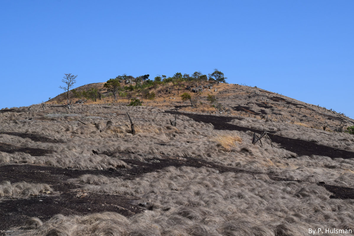
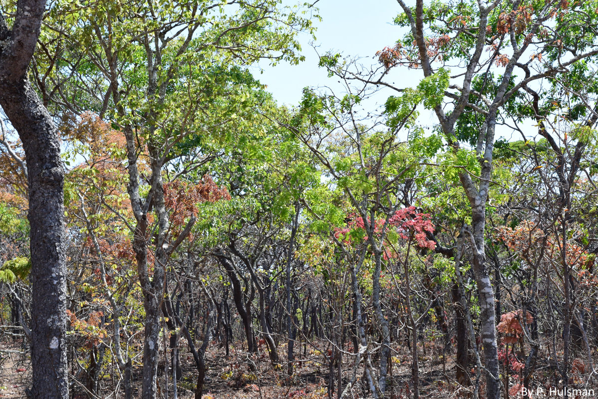
Photos from the original ZAMSECUR website · P. Hulsman
OUR PROJECT · ZAMBIA · 2026
Testing GNSS water-level measurements
We are six MSc Civil Engineering students from Delft University of Technology, working with the University of Zambia and other partners to test water-level monitoring along the Zambezi River. Our fieldwork focuses on the TAHMO GNSS-IR (TGIR) instrument: a low-cost, solar-powered system that uses navigation satellite signals to measure water levels without touching the water.
Why we are testing it
Reliable water-level observations are needed for flood and drought forecasting, reservoir operation and water management. These decisions affect hydropower, agriculture and food security across the region. Yet collecting and transmitting measurements can be difficult at remote river sites where power and mobile coverage are limited.
The pilot builds on the TEMBO Africa project’s work on affordable water and weather monitoring. The aim is to reduce both installation and operating costs, with technology that can be maintained locally. Along the Zambezi, we are testing how TGIR performs under field conditions and how its measurements can support existing monitoring networks. Comparison with established gauges is an important part of evaluating its accuracy and practical value.
How GNSS reflectometry works
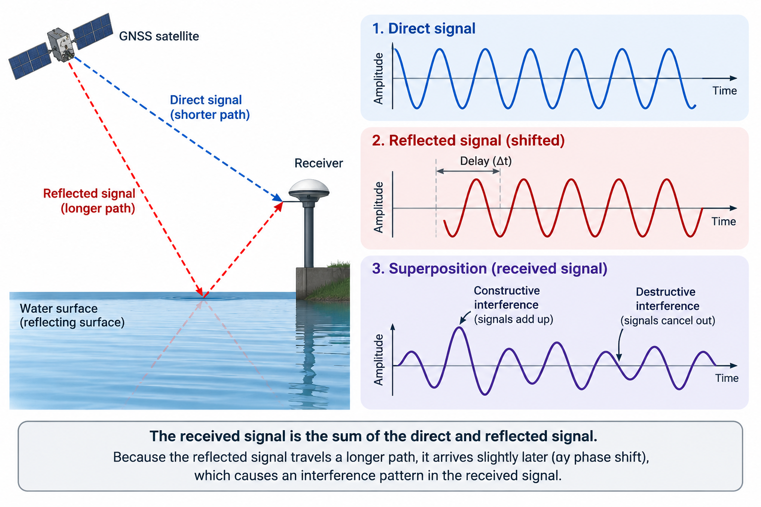
The antenna receives signals from navigation satellites both directly and after reflection from the water. As a satellite moves across the sky, these signals interfere, creating fluctuations in signal strength. Their frequency allows us to estimate the vertical distance between the antenna and the water surface. A smaller distance means a higher water level.
TGIR processes the signals on site and sends the resulting measurements by satellite. Solar power and satellite communication allow it to operate independently of the electricity grid and mobile networks, without major civil works. The dashboard brings the transmitted measurements together for comparison and analysis.
GNSS interferometric reflectometry · from our embassy presentation.
ZAMSECUR NETWORK
Partners
Academic institutions
Delft University of Technology (TU Delft)
University of Zambia (UNZA)
University of Zimbabwe (UZ)
SADC–WaterNet
Water authorities
Water Resources Management Authority (WARMA)
Zimbabwe National Water Authority (ZINWA)
Autoridade Regional de Águas do Zambeze (ARA-ZAMBEZE)